
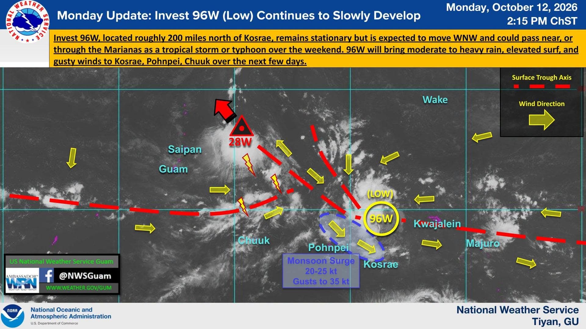
The National Weather Service Guam Weather Forecast Office continues to monitor Invest 96W, which could develop into a tropical storm or typhoon before passing through or near the Marianas.
As of 2:15 p.m. Monday, 96W was 200 miles north of Kosrae and “slowly” developing. According to the NWS Guam Facebook account, the Joint Typhoon Warning Center has upgraded the system to a “Low” rating, which means development is likely but not expected in the next 24 hours.
With the system still days away, weather officials are unable to gauge its intensity at the time of passage, noting that “models are not in agreement.”
“This system will continue to be monitored for further development. Residents in Kosrae, Pohnpei and Chuuk should prepare for the possibility of heavy rain, elevated surf and gusty winds. Residents in the Marianas should maintain a general state of preparedness for the possibility of a passing tropical cyclone,” NWS said.
NWS officials are also watching Invest 95W, east of the Marianas, which has been upgraded to Tropical Depression 28W, with maximum sustained winds of 30 knots.
“28W is moving north-northwest and is expected to track to the northwest over the next few days, passing through the far northern CNMI near Agrihan as a tropical depression Tuesday night,” NWS said.