
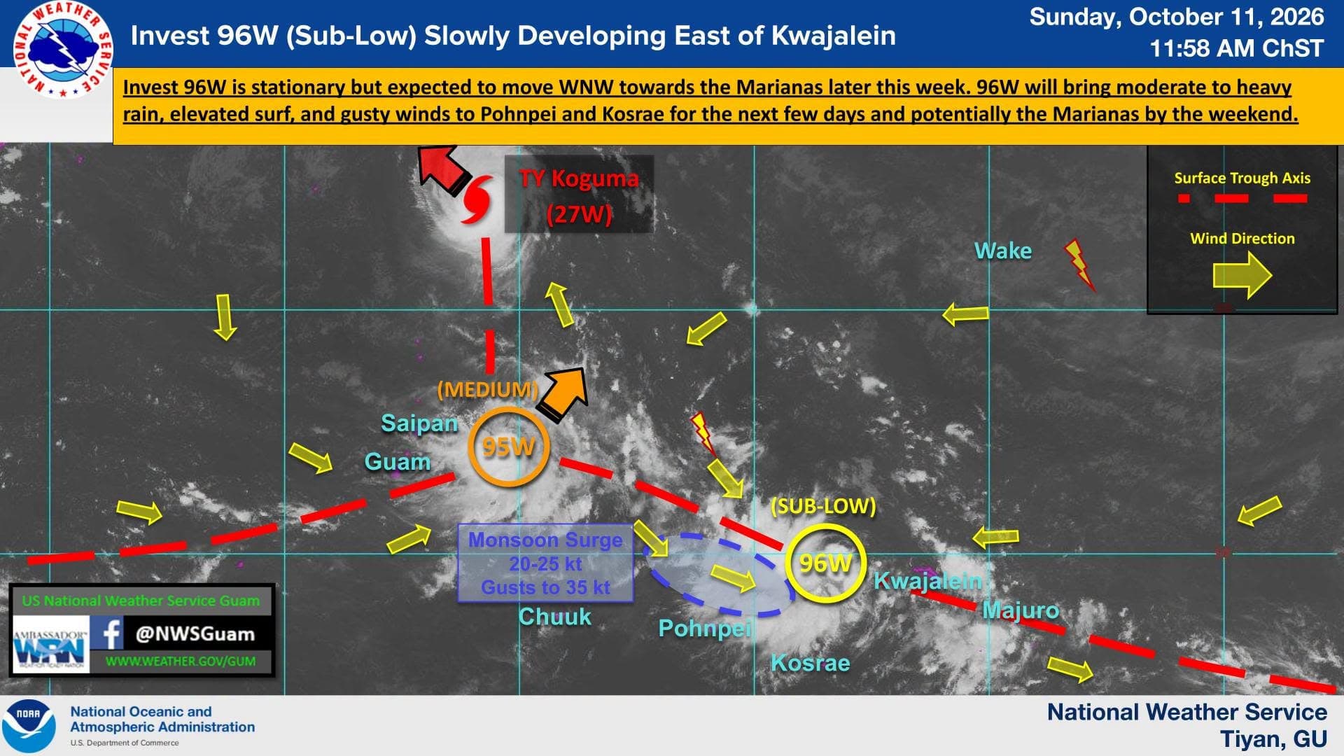
The National Weather Service Guam is keeping an eye on Invest 96W, which on Sunday was developing “slowly” east of Kwajalein.
According to weather officials, the system is currently rated “Sub-Low” by the Joint Typhoon Warning Center, which means development is possible but not anticipated for “at least the next few days.”
“The monsoon tail associated with 96W is expected to bring moderate to heavy rain, elevated surf and gusty winds to Pohnpei and possibly Kosrae starting tonight and lasting several days. Isolated gusts up to 35 knots will be possible in heavier rainbands and thunderstorms. This monsoon tail may also expand into Chuuk by late this week. Forecast guidance indicates 96W continuing to organize over the next few days and begin moving WNW towards the Marianas,” NWS Guam said on its Facebook page Sunday.
Weather officials stressed that uncertainty in the track and intensity of 96W remains, noting the system may pass “anywhere from south of Guam to Pagan in the far northern CNMI likely sometime next weekend.”
“This system will continue to be monitored for further development and residents in Kosrae, Pohnpei, Chuuk and the Marianas should prepare for the possibility of heavy rain and gusty winds,” NWS said.
NWS Guam is also tracking two other weather events.
“Invest 95W to the east of the Marianas and Typhoon Koguma (27W) are moving away from the Marianas. 95W is rated ‘Medium,’ meaning development into a tropical cyclone is likely but expected to occur beyond 24 hours. 95W is moving northeast and is expected to turn back to the northwest over the next few days, passing through the far northern CNMI near Agrihan, possibly as a tropical depression or weak tropical storm. Typhoon Koguma is moving northwest towards Japan and will continue to bring slightly elevated surf on north-facing reefs of the Marianas for the next couple of days,” NWS said.