
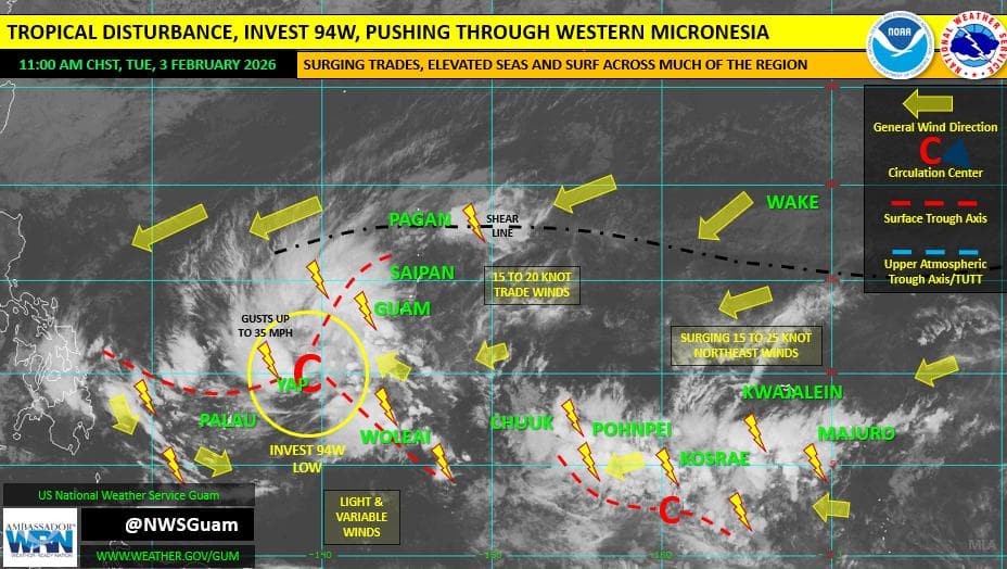
A wet and unsettled weather pattern will linger across the Marianas through midweek as a tropical disturbance and nearby trough keep showers in the forecast, according to the National Weather Service in Guam.
Forecasters said showers could be heavy at times through Wednesday, with brief gusty winds. Conditions are expected to improve later in the week before another round of showers arrives this weekend, potentially tied to a second disturbance now over Micronesia.
Seas of 7 to 9 feet are gradually subsiding and are expected to fall to 5 to 7 feet by Thursday. Surf remains elevated, and a high risk of rip currents continues for Guam and the Commonwealth of the Northern Mariana Islands.
Farther southwest, Invest 94W near Yap State is producing widespread showers and thunderstorms across Palau, Yap and surrounding waters. While development into a tropical cyclone is considered unlikely in the next 24 hours, gradual strengthening is possible in the coming days as the system moves west. Heavier showers could still bring brief strong wind gusts.
Across Chuuk, Pohnpei, Kosrae and Majuro, another weak disturbance and the Intertropical Convergence Zone are keeping scattered showers and isolated thunderstorms in the forecast. Periods of heavier rain are possible, especially over central Micronesia. Some improvement is expected by the weekend.
Drought conditions remain minimal across most of the region, though moderate drought persists in parts of the northern Marshall Islands and Pingelap in Pohnpei State.
Advisories in effect include a high risk of rip currents for Guam and the CNMI and a Small Craft Advisory for Pohnpei waters.
Residents are urged to stay updated with the latest forecasts, as local conditions can change quickly.