
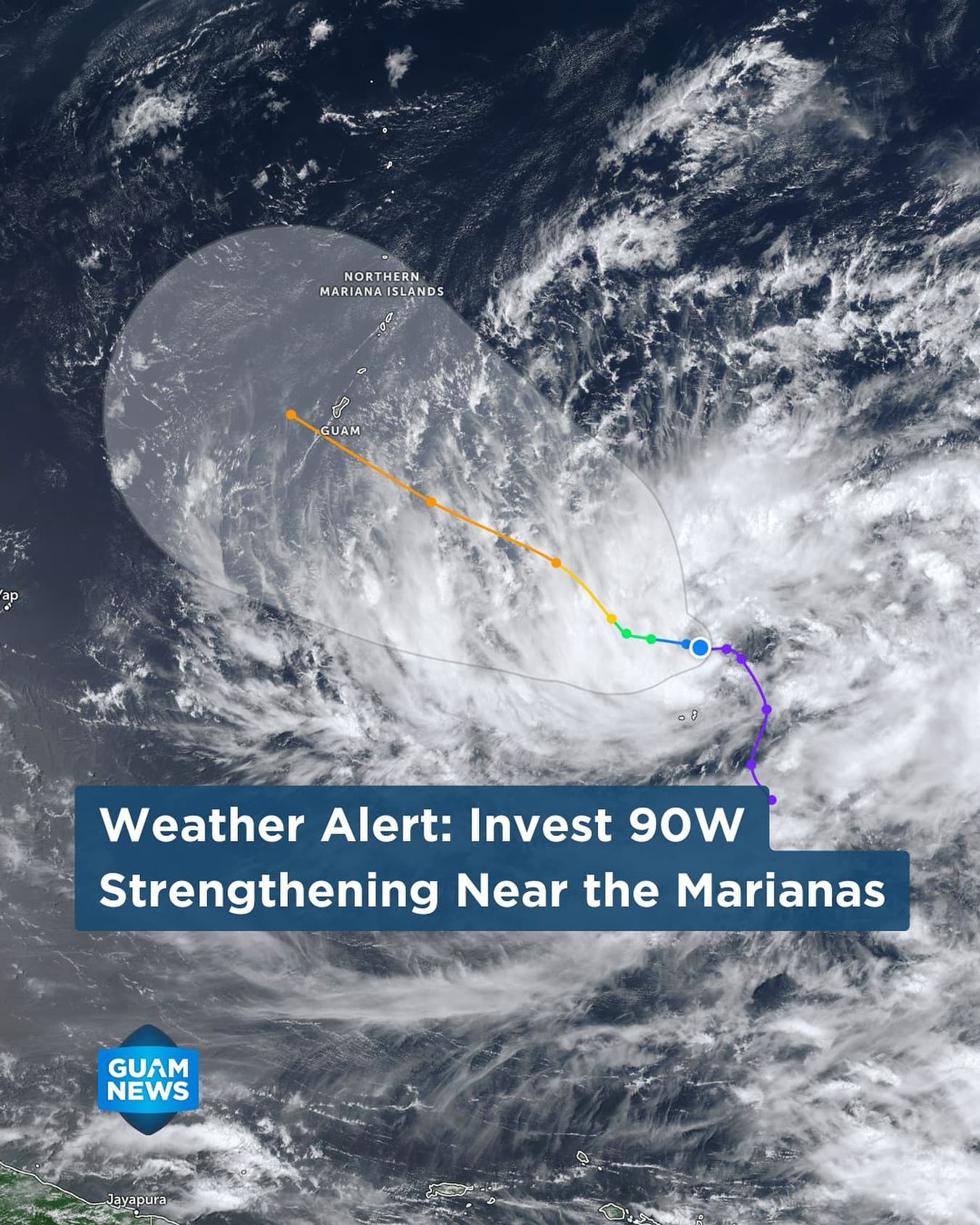
The National Weather Service (NWS) Guam is tracking Invest 90W, an intensifying tropical disturbance currently located about 570 miles east-southeast of Guam. While current guidance suggests the system is most likely to pass south of Guam, residents are urged to remain vigilant as any northward shift could bring the center directly over the islands.
Immediate Outlook: Fair and breezy conditions persist through Friday, though a High Risk of Rip Currents and Small Craft Advisories remain in effect for Guam, Rota, Tinian, and Saipan.
The Shift: Conditions are expected to deteriorate late Saturday with increasing showers and thunderstorms.
Peak Intensity: The heaviest rainfall and the potential onset of damaging winds (39 mph+) are anticipated between Sunday night and early Tuesday.
Authorities are advising a shift from observation to active preparation:
- Secure Infrastructure: Beyond yard debris, residents should secure construction sites and remove temporary structures like tents, canopies, or campaign signs that could become hazards in high winds.
- Resource Management: Validate that emergency kits contain 7–10 days of food and water. This longer window accounts for potential post-storm supply chain delays.
- Mitigation: If you reside in a flood-prone area, clearing private drainage paths now is critical to preventing localized property damage.
Official Resources:
Track shifts in the storm’s path via the National Weather Service and GHS/OCD websites. Given the unpredictability of tropical systems during the intensification phase, daily monitoring is highly recommended through the weekend.