
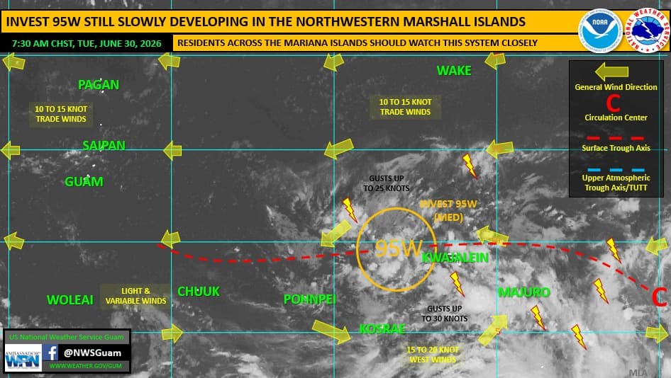
The National Weather Service Guam office is keeping an eye on Invest 95W, a system that forecasters described as a "broad tropical disturbance."
In a Regional Weather Outlook supplemental, NWS Guam said that as of Tuesday, June 30, at 7:30 a.m., Invest 95W was located in eastern Micronesia, centered around the northwestern Marshall Islands, south of Enewetak.
Though the system remained in a "weak and disorganized" state for days, it did generate strong west and southwest winds in the region, resulting in "coastal inundation" along windward coastal areas across the Marshall Islands, with some wind damage reported in Majuro.
NWS Guam said a special weather statement is in effect for Majuro, Kosrae and Pohnpei.
For the Marianas, Invest 95W maintains a "medium" rating for potential development.
"This means that development into a tropical depression is likely, but beyond 24 hours," an NWS Guam forecaster said, noting the pattern has persisted for a "couple of days" as Invest 95W organizes around a single, dominant low-level circulation center (LLCC).
Forecasters explained that Invest 95W's development has been gradual.
"Once a LLCC is better defined and 95W begins to move out of the RMI, there'll be increased clarity on potential forecast track, timing and intensity," NWS Guam officials said.
Current long-range model data points toward passage "somewhere east" of or through the Marianas late this weekend or early next week.
"This is a trend we'll have to watch closely, particularly as 95W continues to meander in eastern Micronesia," NWS Guam said.
Forecasters are encouraging residents in the Marianas to stay informed and prepared should preparedness measures become necessary.