
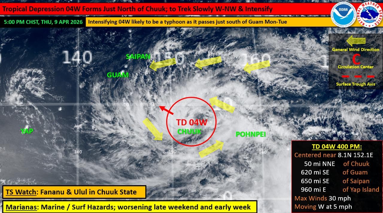
Emergency officials are urging residents to prepare as Tropical Depression 04W continues to organize and move toward the Marianas, with the potential to intensify into a typhoon in the coming days.
The system, formerly known as Invest Area 90W, has strengthened over the past 12 hours and is tracking west-northwest toward the region. As of 4 p.m. Thursday, it was located about 620 miles southeast of Guam, with sustained winds of 30 mph and moving west at 5 mph.
Forecast guidance from the Joint Typhoon Warning Center indicates the system could intensify into a Category 2 typhoon and pass just south and southwest of Guam between Monday and Tuesday. Officials noted a slight northward shift in the projected track, increasing the potential for impacts on the island.
“At this early time, damaging winds of 39 mph or more are possible as early as Monday morning, with destructive typhoon-force winds of 74 mph or more possible Monday night for Guam,” the Office of Homeland Security and Civil Defense said in a release.
Weather conditions are expected to deteriorate starting Monday, with increasing showers, thunderstorms and gusty winds. Breezy trade winds will continue through the weekend before the system approaches.
Officials stressed there remains uncertainty in the storm’s speed and track, warning that even slight shifts could significantly change impacts across Guam and the Marianas.
Residents, particularly those in flood-prone areas, are urged to begin preparations immediately. Recommended actions include clearing storm drains, securing loose outdoor items, and preparing emergency kits with enough food, water and supplies for seven to 10 days.
Officials also advised securing construction sites, removing signs that could become airborne, safeguarding important documents and reviewing family emergency plans.
Authorities continue to monitor the system and are urging the public to stay informed through official updates as conditions evolve.