
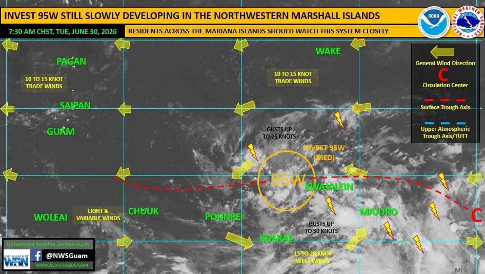
National Weather Service Guam said Invest 95W will likely develop into a tropical depression in the next 24 hours and may pass through the Marianas as a tropical cyclone early next week.
As of 8 a.m. weather officials tracked Invest 95W about 399 nautical miles east-northeast of Pohnpei, moving northwestward at around 5 knots.
“It remains in an environment favorable for continued development. It will continue moving generally northwestward,” NWS officials said in the Regional Weather Outlook issued Wednesday morning.
Forecasters explained the Invest 95W has been gradually developing and now shows a broad cyclonic flow extending north and south of the low-level circulation toward the equator.
With gradual development overnight, the Joint Typhoon Warning Center (JTWC) upgraded the potential for development into a tropical depression from MEDIUM to HIGH.
For Guam, the tracking means that Invest 95W could pass "somewhere through the Marianas ... likely passage region span from just south of Guam northward through Pagan Island."
Weather officials encourage residents in the Marianas to "watch this system closely" and prepare for "some degree of impacts Sunday and Monday."
"It’s not yet clear where exactly 95W will pass through the region, or at
what intensity, but we have 4+ days, and a lot of distance for things to shift, develop and evolve," NWS said.