
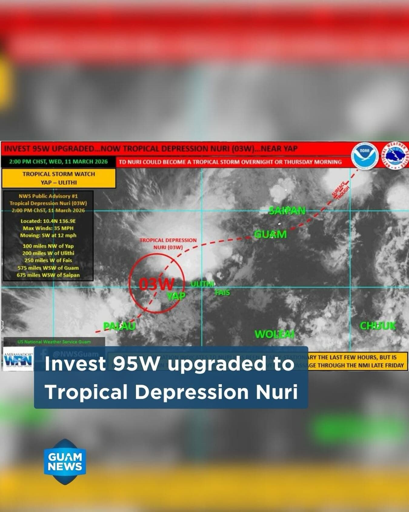
The Office of Guam Homeland Security and Office of Civil Defense says forecasters are now tracking Tropical Depression Nuri, formerly known as Invest 95W, as it develops in the western Pacific.
According to the National Weather Service Guam Weather Forecast Office, the system was located Wednesday afternoon near 10.4°N, 136.9°E — about 100 miles northwest of Yap and roughly 575 miles west-southwest of Guam.
The system was moving southwest with maximum sustained winds of 35 mph and is expected to intensify through tonight, possibly becoming a tropical storm before gradually weakening beginning Friday.
Forecast models indicate Nuri will turn northeast and pass near or north of Anatahan in the Northern Mariana Islands. While tropical-storm-force winds are not currently expected for Guam, officials warn that any shift southward in the storm’s track could bring stronger winds to the island.
What to Expect
Forecasters say Guam could experience heavy rain and isolated thunderstorms over the next 48 to 60 hours, with wind gusts up to 35 mph. Rainfall totals of 2 to 4 inches, with locally higher amounts, are possible from Thursday through Friday night, along with sustained winds of 20 to 30 mph.
Preparedness Reminders
Emergency officials are urging residents to prepare now by clearing drainage areas, securing loose outdoor items and staying updated on weather advisories.
Drivers are also reminded to use caution during heavy rain and avoid flooded roads.
Officials emphasized the safety message “Turn Around, Don’t Drown,” noting that just six inches of moving water can knock a person down and two feet can sweep away a vehicle.
Residents are encouraged to monitor updates from the National Weather Service and Guam Homeland Security as the system approaches the Marianas.