
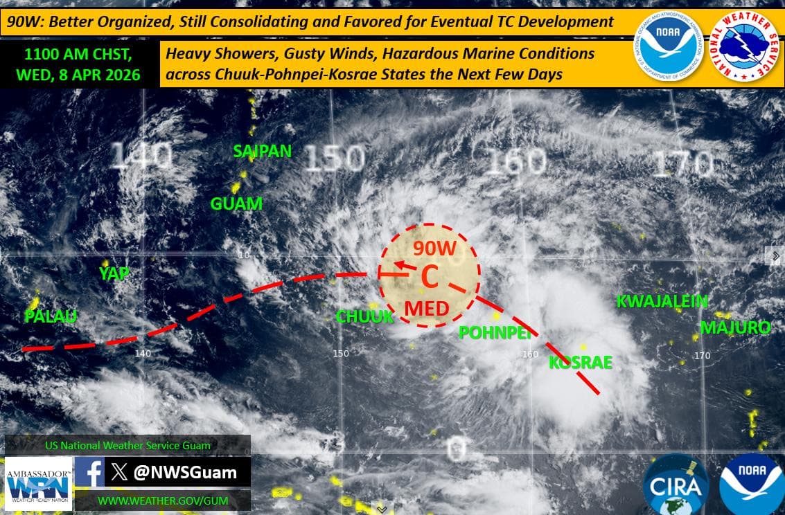
A tropical disturbance known as Invest Area 90W is being closely monitored as it continues to organize east-northeast of Chuuk, with National Weather Service Guam warning of possible impacts to the Marianas in the coming days.
The Joint Typhoon Warning Center has raised the system’s development potential to medium, indicating it is likely to strengthen into a tropical depression beyond the next 24 hours.
Satellite imagery shows the system has become more organized and has shifted northwest from its previous position south of Pohnpei. However, uncertainty remains regarding its exact track, intensity, and timing.
Forecast models currently vary on whether the system will move west or northwest, and whether it could pass south of Guam, directly over the Marianas, or farther north. Timing also remains uncertain, with potential impacts ranging from late this weekend into early next week.
Even before any direct effects, outer bands are expected to bring worsening conditions across parts of Micronesia. Heavy rain, gusty winds, and hazardous seas are forecast for Pohnpei State and Kosrae State in the next couple of days, with similar conditions expected in Chuuk State.
For the Marianas, fair trade-wind weather is expected to continue through the work week. However, conditions are forecast to deteriorate as the system approaches, bringing increasing winds, heavier rainfall, and rough marine conditions over the weekend and into early next week.
Forecasters say even a track south of Guam could still produce strong, gusty winds and hazardous seas due to enhanced trade winds.
Residents are advised to monitor updates as the system develops and forecasts become more refined.