
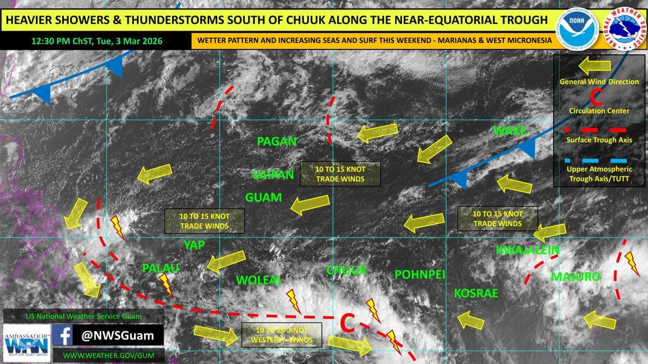
Drier conditions are spreading across Guam and the CNMI following heavy rainfall earlier this week, but forecasters say winds, seas and shower activity could increase by the weekend.
According to the National Weather Service Guam Weekly Regional Weather Outlook issued March 3, fairer weather is expected to continue through Friday after a weakening shear line moved across the Marianas on Monday.
However, a disturbance is expected to develop within the near-equatorial trough south of Chuuk and shift west-northwest by the weekend. At the same time, a cold front pushing off Japan is forecast to move south and transition into a shear line. The combined influence of these systems could increase winds across the Marianas, building seas and surf and raising the potential for heavier showers and thunderstorms.
Seas of 5 to 7 feet and moderate trade winds are expected through at least Thursday before conditions begin building over the weekend.
A high risk of rip currents remains along east-facing reefs and beaches through Tuesday afternoon.
Across Yap and Palau, patchy showers and isolated thunderstorms are being observed, with seas also around 5 to 7 feet. A developing disturbance could bring gusty winds and locally heavy rainfall to those areas later this week. A northerly swell is expected to add to choppy seas and elevated surf this weekend.
In Chuuk and parts of the Marshall Islands, scattered showers and isolated thunderstorms are continuing along trade-wind troughs. Periods of unsettled weather are expected to spread toward Kosrae and Pohnpei over the next several days.
The outlook notes no current tropical cyclone threats within the Guam area of responsibility. However, forecasters are monitoring the Madden-Julian Oscillation, which could create a more favorable pattern for tropical development in the western Pacific in the coming weeks.
Meanwhile, abnormally dry conditions persist in Yap Proper and Lukunor, while parts of the northern Marshall Islands remain in severe drought