
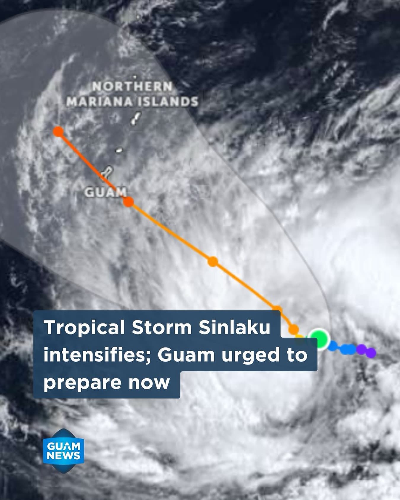
The National Weather Service has upgraded Tropical Depression 04W to Tropical Storm Sinlaku. The system is intensifying rapidly, with current projections indicating it could reach Category 3 or 4 status, boasting sustained winds of approximately 120 mph, as it makes a close approach to the Marianas.
- The Window of Impact: Damaging winds (39 mph+) could arrive as early as Monday morning.
- Peak Intensity: Destructive typhoon-force winds (74 mph+) are possible for Guam Monday night through early Tuesday morning.
- Major Hazards: Due to the system’s slow movement and large wind field, residents should prepare for prolonged exposure to heavy rainfall, significant flooding, and high-velocity winds, even if the center does not make a direct hit.
Authorities are urging the community to move from “monitoring” to “active preparation” immediately:
- Infrastructure & Yard Safety: Secure construction sites and remove potential projectiles such as tents, canopies, and political signs.
- Flood Mitigation: Residents in flood-prone areas must clear drainage paths and storm drains now to manage the anticipated heavy rainfall.
- Sustenance & Records: Ensure your emergency kit is stocked for 7–10 days. Protect vital documents (birth certificates, insurance, tax papers) in waterproof containers.
- Vulnerable Planning: Review emergency plans for family members with disabilities, the elderly, and pets.
The situation is evolving quickly as Sinlaku intensifies. Continuous monitoring of official channels is vital for safety.
Official Sources for more info:
NWS Guam: weather.gov/gum
GHS/OCD: ghs.guam.gov